What country in the world has the longest coastline?
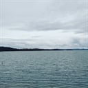
Canada covers 9,984,670 km (3,855,100 sq mi) (3,855,103 sq. miles) and has a panoply of various geoclimatic regions. Canada encompasses vast maritime terrain, with the world's longest coastline of 243,042 kilometres (151,483 mi). The physical geography of Canada is widely varied. Boreal forests prevail throughout the country, ice is prominent in northerly Arctic regions and through the Rocky Mountains, and the relatively flat Canadian Prairies in the southwest facilitate productive agriculture. The Great Lakes feed the St. Lawrence River (in the southeast) where lowlands host much of Canada's population.
Canada, the second largest country in the world by total area, comprises ten provinces and three territories. Canada also has the longest total coastline among all of the countries of the world. The country’s coastline fronts on the Pacific Ocean to the west, the Atlantic Ocean to the east, and the Arctic Ocean to the north. Most of the Canadian provinces and territories, with the exception of Alberta and Saskatchewan, have their own respective coastlines. The coastline of the country exhibits varied landscapes across different parts of the country, and most shoreline types are present around the Canadian coastlines, with the exception of such tropical and subtropical ecosystems as mangrove swamps and coral reefs.
More Info:
www.worldatlas.com